Saturday, August 18, 2018

Middlesex Fells - Boston

Skyline Trail -> Silver Mine Path -> Middle Road - Skyline Trail
Distance: 3.63 mi.
Elevation Gain: 341 ft.
Start Time: 7:07am
End Time: 8:01am

Trip Report:
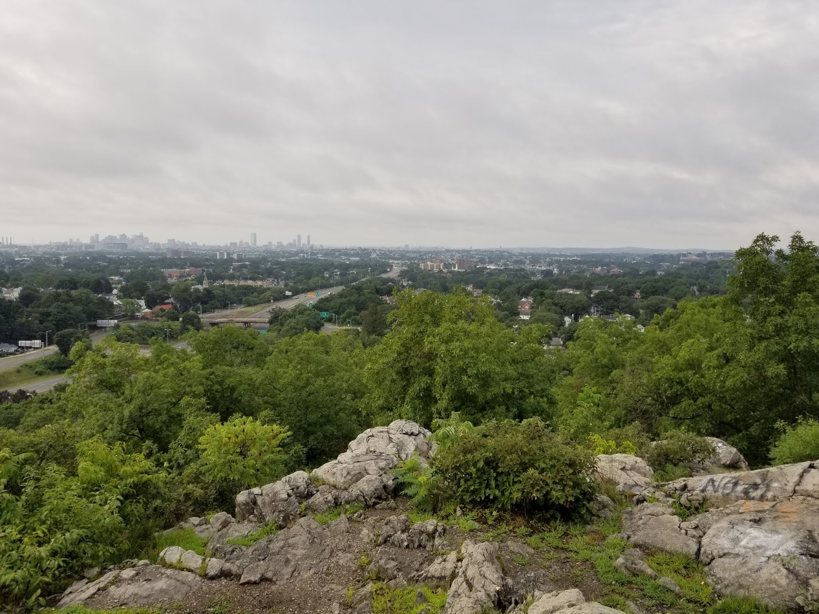
The Middlesex Fells Reservation north of Boston is a treasure trove of trails that all Boston-ites should consider themselves lucky to have. As a guest, I also found it wonderfully easy to access and enjoy. I did a minimal amount of research on the trails, stumbling upon the Skyline Trail first of all to get an understanding of what I might want to do. There are also a number parking lots providing immediate access to the trails. I opted to park on the very southeast side to gain quick access to the Skyline Trail.

Thursday, August 16, 2018

Katahdin

Katahdin
Hunt Trail and the northern terminus of the Appalachian Trail
Trailhead Elevation: 1,089 ft.
Summit Elevation: 5,269 ft.
Distance: 9.78 mi.
Elevation Gain: 4,186 ft.
Start Time: 6:46am
Summit Time: 9:24am (13 mins)
End Time: 12:01pm

Trip Report:
When my wife and I set out to plan a trip to the Northeast to celebrate our anniversary and we settled upon New Hampshire and Maine as our destinations, I knew that Katahdin would have to be a target high on the list of attractions. I haven't fully put a finger on it yet, but for me there has been something majestic about this mountain and how it feels in my mind compared to many others I've hiked. Certainly it is famous and that has something to do with it. Katahdin is the highest point in the State of Maine. Katahdin is also the northern terminus of the epic Appalachian Trail. That latter point is perhaps the most moving for me. All of that aside, it is also just a wonderful hike and mountain climb and one to be enjoyed with great care. As I reflect in hindsight on this hike I have to admit it was much more than I was expecting, and that's a good thing.

Wednesday, August 15, 2018

Precipice, Champlain South and Beehive Trails (Acadia NP)

Precipice Trail to Mount Champlain to Champlain South Ridge Trail to Beehive Trail and Bowl Trail to Sand Beach
Precipice TH Elevation: 117 ft.
Mt. Champlain Elevation: 1,054 ft.
Beehive Elevation: 529 ft.
Sand Beach Elevation: 24 ft.
Distance: 4.15 mi.
Elevation Gain: 1,337 ft.
Start Time: 10:07am
End Time: 12:17pm


Trip Report:
The Precipice Trail and the Beehive Trail are noted as being a couple of the classic hikes in Acadia, well loved by visitors. On one hand this is a bit surprising given the inherent danger each contains, particularly on the Precipice Trail, on the other hand, given the thrills and views, I can see why many partake anyways. Each trail has high exposure and the use of iron rungs mounted into the rock to assist with climbing and safety. Its not quite a full blown via ferrata where you are walking over nothing, but a few sections get close. There was also no use of ropes or clipping into any anchors as other even more exposed routes have. As I hiked each of these I kept pondering just how one ranks a route such as this. There is some rock climbing involved and the use of iron rungs on rock which would otherwise be class 5 climbing. There is massive exposure in many places on the Precipice Trail and there is the effort to do all of this. I certainly would put this in the category of a full class 5 climb with ropes and protection. On the other hand, even with the iron bar assists this is a bit more than your typically class 2 or class 3 climb. I think in terms of technical ability I would classify this in the range of easy class 3. But the exposure in parts on Precipice goes pretty high up on the scale.

Tuesday, August 14, 2018

Wild Gardens Trail + Ocean Path Trail (Acadia NP)

Elevation: from 20 to 108 ft.

Wild Gardens
Distance: 0.90 mi.
Elevation Gain: 44 ft.
Start Time: 1:05pm
End Time: 1:35pm

Ocean Path (Sand Beach to Thunder Hole) (8/14/2018)
Distance: 1.81 mi.
Elevation Gain: 144 ft.
Start Time: 2:08pm
End Time: 3:05pm

Ocean Path (Monument Cove to Otter Point) (8/15/2018)
Distance: 1.22 mi.
Elevation Gain: 111 ft.
Start Time: 2:34pm
End Time: 3:09pm

Trip Report:
At the Sieur de Monts Nature Center we began a lovely little hike walking through the various Wild Gardens. They had sectioned areas of different environments and the types of plants that would be found there. There were simple pea gravel trails all about the gardens to walk upon. When we had our fill of the garden we decided to get a little more hiking in and moved south on the Jesup trail towards a pond we could see on the map. This was perhaps a 3/4 mile walk and we ended up at what was called The Tarn. Due to the foggy weather of the day the views were limited but still found the Tarn to be a rather beautiful spot. On the hike back we worked a parallel trail called the Wild Gardens Path and returned to the nature center.

Monday, August 13, 2018

Mt. Washington to Lakes of the Clouds

Mt. Washington to Lakes of the Clouds
Crawford Path and Appalachian Trail
Summit Elevation: 6,228 ft.
Lakes Elevation: 5,051 ft.
Distance: 2.80 mi.
Elevation Gain: 1,214 ft. (my GPS)
Start Time: 3:18pm
End Time: 4:32pm

Trip Report:
The hike up Mount Washington is a classic for anyone. It is perhaps the most iconic summit in America east of the Rockies. It has many enticing routes and the allure (or danger?) of crazy weather. When my wife and I flew into Manchester, New Hampshire for our anniversary trip we drove on up to Washington to enjoy the auto road to the top. Here, I had debated finding a hike to the top, likely on the Tuckerman Ravine trail, but time wouldn't allow it this time around. Instead, I had shared ahead of time that when we drove to the summit I would look for a short hike down from the summit and back up. That became the plan.

Popular Posts