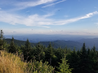
Clingmans Dome from Newfound Gap
Appalachian Trail
Newfound Gap Elevation: 5,049 ft.
Distance: 8.96 mi.
Elevation Gain: 2,796 ft.
Start Time: 2:38pm
End Time: 7:45pm
Trip Report:
All throughout our week at Pigeon Forge and Great Smoky Mountains National Park I had contemplated a fun way to do a family activity with Clingmans Dome. I also wanted to make sure we had the chance to hike it. The obvious solution kept pointing out a group hiking it from Newfound Gap with the remainder driving the road to the top. The main question was merely who would join the hike and when to go. The plans ended up getting pushed to our last day.
Our group of 8 for the hike made it to Newfound Gap just after 2:30pm and we parked and made ready to go. We carried the basics of food and water but not much else. The weather was looking pretty good for our afternoon. Though temps were around 90 down in Gatlinburg, it was just over 70 up at 5,000 feet. We made our way on to the Appalachian Trail crossing the highway at the gap.
Text
✝ See Faith Posts for my new content in the absence of Monroe News Faith Columns.
✝ See Published Articles for my old Faith Columns and other content.
⛰ My blog also contains numerous Trip Reports from adventures I've had.
✝ See Published Articles for my old Faith Columns and other content.
⛰ My blog also contains numerous Trip Reports from adventures I've had.
Showing posts with label North Carolina. Show all posts
Showing posts with label North Carolina. Show all posts
Sunday, July 24, 2022
Friday, December 27, 2019
Newfound Gap
Trailhead Elevation: 5,045 ft.
Distance: 1.11 mi. (my Forerunner 230)
Elevation Gain: 305 ft. (my GPS)
Start Time: 8:42am
End Time: 9:09am
Trip Report:
A simple hike today. We're in the midst of a long drive from Michigan down to Florida to visit family over the Christmas holiday. When I was planning out the driving route I saw the option to drive through the Great Smoky mountains was only slightly further. This seemed like a good choice for the way down. I then began to look for hiking options that we could make a quick strike with. Newfound Gap was the obvious choice. We could start up from the road and not leave our primary route for very long. The fact that the Appalachian Trail passed through here also helped.
Subscribe to:
Posts (Atom)
Popular Posts
-
Penosha Trail: Brighton State Recreation Area Trailhead Elevation: 921 ft. Distance: 4.8 mi. (my GPS) Elevation Gain: 834 ft. (my GPS) ...
-
Ash Hollow State Historic Park / Oregon National Historic Trail Windlass Hill Trail Trailhead Elevation: 3,500 ft. Distance: 0.63 mi. (ro...
-
Route Name: Dewey Lakes Trails Start Elevation: 36 ft. Lake Elevation: 3,083 ft. Distance: 5.6 mi. Elevation Gain: 3,155 ft. Start Tim...
-
Route Name: South Ridge from Nellie Creek Start Elevation: 11,400 ft. (4WD TH) Summit Elevation: 14,309 ft. Elevation Gain: 2909 ft. Rou...
-
Anglemeyer Lake Backpacking North Cottonwood Creek trail into Horn Fork Basin + Bushwhacking to Anglemeyer Lake Trailhead Elevation: 9,887...
-
Photo Point Trail + Nugget Falls Trail at Mendenhall Glacier Tongass National Forest Trailhead Elevation: 83 ft. Distance: 2.10 mi. (my F...
-
Frisco -> Mt. Royal Trail -> Mt. Victoria -> Peaks 1-10 -> Breckenridge Ski Resort Trailhead Elevation: 9,094 ft. Distance: 16...
-
Mt. Washington to Lakes of the Clouds Crawford Path and Appalachian Trail Summit Elevation: 6,228 ft. Lakes Elevation: 5,051 ft. Dista...
-
Pine Creek Trail plus other adventures. Trailhead Elevation: 8,806 ft. First Camp Elevation: 10,970 ft. High Camp Elevation: 11,640 ft. Tota...
-
Jump to Lake Michigan Overlook Climb Sleeping Bear Point Trail Sleeping Bear Point is at the northern end of the National Lakeshore. It is ...


