Sunday, July 26, 2020

Kroenke Lake and Brown's Pass

North Cottonwood Trail to Kroenke Lake Trail to Brown's Pass
Trailhead Elevation: 9,961 ft.
Kroenke Lake Elevation: 11,530 ft.
Pass Elevation: 12,547 ft.
Distance: 11.23 mi. (my Forerunner 235)
Elevation Gain: 3415 ft. (my Forerunner 235)
Start Time: 5:50am
End Time: 11:55am


Trip Report:
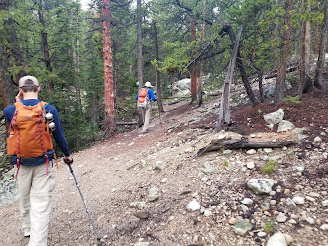
The 2020 July monsoon ran in full force. Many would say "well that's just 2020". If it can happen, it will happen. We're used to seeing rain in the forecast daily in late July, but much of the time its a 50/50 thing and more of than not things work out. This year? Not so much. Today's forecast was something like 20% chance rain til 10am and then 80% chance rain the rest of the day. This again foiled our hopes of going for a big summit and spending good time above treeline. We played it safe in our decision making.

Saturday, July 25, 2020

High Dune (Great Sand Dunes NP)

No trail, open route up to High Dune
Trailhead Elevation: 8,242 ft.
High Dune Elevation: 8,709 ft.
Distance: 1.93 mi. (my Forerunner 235)
Elevation Gain: 850 ft. (my Forerunner 235)
Start Time: 9:44am
End Time: 10:49am


Trip Report:
We hit all the nails on the head with our visit to Great Sand Dunes. We had read on the NPS website beforehand about the potential for 2-hour waits for entry at midday on weekends. We were planning to head down there on a Saturday morning before my brother and his family had to leave town. We made it down there just after 9am and had only 2 cars at the entry booth ahead of us. When we left later on around noon the line may have been 30-40 cars deep. Arriving early also helped with parking. The Dunes Parking lot is definitely not big enough to handle a busy summer day. The lot was probably 90% full when we arrived. Later as we were leaving cars were hunting spots in the lot and ending up parking along the road or in the picnic area up the hill. We also hit the weather well today. Temps were low 60s and almost felt cool with a light breeze upon arrival. The temp maybe hit low 70s when we had left. The cloud cover stay consistent and so the sun never really had a chance to overheat the sand. All of this made for great hiking weather.

Friday, July 24, 2020

Immovable Mountains

[Originally published in the Monroe News on July 24, 2020]

If you’ve ever been out to the Great Sand Dunes National Park in Colorado you’ll likely have strong memories of the shifting sand dunes which make up the park’s namesake.  But will you also remember the crowning peaks that sit at the north end of the park?  The tallest of them is a beautiful giant of a peak with amazing red conglomerate sandstone named Crestone Peak.  It is made of such a sturdy rock one could wonder if such a mountain would stand forever.

In 2008 I was on a climbing adventure with my father and brother and we were seeking to climb Crestone Peak.  Its summit stands at 14,294 feet above sea level.  Its no easy climb.  To gain the summit of this peak you have to climb up a steep, narrow red gully of rock which is over a 1000 feet tall.  If you have fears of heights this definitely wouldn’t be a place for you.  Compounding the challenge for us in 2008, about halfway up the gully a snowfield still remained from heavy winter snows.  While climbing on steep snow is very do-able if you have the right equipment and skill, it is also an unforgiving activity.  A fall on such snow could easily send you flying down the mountain into a bed of rock.

Silver Creek to Point 12505

Silver Creek TH, Colorado Trail to Pass then unmarked trail to Point 12505
Trailhead Elevation: 9,446 ft.
High Elevation: 12,505 ft.
Distance: 8.85 mi. (my Forerunner 235)
Elevation Gain: 4,088 ft. (my Forerunner 235)
Start Time: 8:44am
End Time: 12:13pm


Trip Report:
This hike came about on a whim. Our initial intentions for this morning were to hit a 14er summit but the weather reports were pretty poor for above treeline. Couple this with a bit of a later start and a big summit was sailing out the door. Nonetheless we didn't want to lose a good day out in Colorado. We left the house, my brother and I, with the intentions of heading up the North Cottonwood trail to Kroenke Lake. As we headed up the road my brother mentioned trying a different trail today as we had ended up yesterday's hike on Mt. Harvard in the same spot here. So I mentioned the Silver Creek trailhead and the nice hike it offered. We opted for this and changed course.

Thursday, July 23, 2020

Mt. Harvard Traverse

Frenchman Creek Trail to Harvard Summit and descent on Mt. Harvard trail through Horn Fork Basin to N. Cottonwood Creek trail.
Start Elevation: 9,414 ft.
Summit Elevation: 14,420 ft.
Finish Elevation: 9,892 ft.
Distance: 14.30 mi. (my Forerunner 235)
Elevation Gain: 5300 ft. (my Forerunner 235)
Start Time: 5:37am
End Time: 1:46pm


Trip Report:
I've had my eye on a return trip to Harvard in recent years. I first climbed it in 2010 with my friend Matt when we did the Harvard-Columbia traverse from our campsite in Horn Fork Basin. I instantly fell in love with the area. I wanted to change the route up slightly this time. I had read good things about the Frenchman Creek approach and decided to make a scenic up-and-over route on Harvard to keep things fresh. With all of this being relatively close to my folks place in the BV area we had an easy way to get vehicles in place for the two trailheads we'd be using.

Wednesday, July 22, 2020

Harvard Lakes Backpacking - And a Missing Hiker

Three Elk trail to Colorado Trail
Lower Trailhead Elevation: 8,831 ft.
Upper Trailhead Elevation: 9,302 ft.
Harvard Lakes Elevation: 10,246 ft.

Hike In
Start Time: 4:57pm
End Time: 6:07pm (6:59pm)
Distance: 1.91mi. (4.18 w/ search)
Elevation Gain: 1082 ft. (1309 w/ search)

Hike Out
Start Time: 8:40am
End Time: 9:55am
Distance: 2.77mi. (to lower TH)
Elevation Gain: 116 ft.


Trip Report:
This summer was the first time my whole family and my brother's whole family would be together in Colorado and staying at my parent's house. This meant wonderful amounts of family time and opportunities to give the kids new experiences in the backcountry. I knew immediately I wanted to find a way to take out all the young cousins backpacking. My boys have had a few short experiences already and the chance to get my brother's kids out to enjoy the same was enticing. We weighed through a number of options and places of how to accomplish this. One of the times I've taken my boys out was merely hiking a half mile up the North Cottonwood Creek trail and picking a spot. A short excursion like that is necessary with new young backpackers as they likely won't be carrying much of their gear. The adults in the gear get overloaded packs with extra sleeping bags and tents.

Saturday, July 4, 2020

Munising Falls and North Country Trail Run

Munising Falls Trail and an out-and-back trail run on the North Country Trail from Munising Falls TH.
Trailhead Elevation: 662 ft.

Munising Falls Hike
Distance: 0.45 mi. (likely longer, started a little late)
Elevation Gain: 179 ft. (my Forerunner 235)
Time: 4:48pm - 5:03pm

NCT Trail Run
Distance: 4.01 mi. (my Forerunner 235)
Elevation Gain: 322 ft. (my Forerunner 235)
Time: 6:30am - 7:24am


Trip Report:
If you make it to Munising in the Upper Peninsula of Michigan then it is well worth making the short journey to see Munising Falls. In fact there are at least a dozen different waterfalls to see up in this area and this might be one of the best of them. The trail starts at a visitors center for Pictured Rocks just east of the town of Munising.

Friday, July 3, 2020

Au Sable Lightstation (Pictured Rocks NL)

North Country Trail from Hurricane River to the Lightstation
Trailhead Elevation: 626 ft.
Distance: 3.43 mi. (my Forerunner 235)
Elevation Gain: 51 ft. (my Forerunner 235)
Start Time: 12:47pm
End Time: 2:24pm

Trip Report:
When it comes to the nuts and bolts of this hike there isn't a lot to say. It is a straightforward easy hike to follow and to complete. It leaves either from the day-use area at Hurricane River or from the west end of the lower campground. It follows a double-track gravel road out to the edge of the Lightstation complex. Once at the Lightstation there are several buildings to walk around and beautiful fields of wildflowers. Since our hike was during the coronavirus pandemic the buildings were all closed and the usual tour not offered. At the west end of the Lightstation complex the North Country Trail continues eastward toward Grand Marais.

Thursday, July 2, 2020

Miner's Beach (Pictured Rocks NL)

Miner's Castle
Trailhead Elevation: 771 ft.
Beach Elevation: 606 ft.
Distance: 3.06 mi. (my Forerunner 235)
Elevation Gain: 433 ft. (my Forerunner 235)
Start Time: 12:56pm
End Time: 2:35pm

Trip Report:
The Miner's Castle area is a great place to take in some of the best that Pictured Rocks has to offer when you're stuck on land. For most, taking the Pictured Rocks boat cruises to see the amazing cliffs up close from the water will really be the most jaw-dropping way to go. Our family did this cruise back in 2016 on a trip to Michigan's UP and loved it. This year on a return trip we decided to try something different and check things out from the land. It didn't disappoint.

Popular Posts