North Cottonwood Trail to Kroenke Lake Trail to Brown's Pass
Trailhead Elevation: 9,961 ft.Kroenke Lake Elevation: 11,530 ft.
Pass Elevation: 12,547 ft.
 Distance: 11.23 mi. (my Forerunner 235)
Elevation Gain: 3415 ft. (my Forerunner 235)
Start Time: 5:50am
End Time: 11:55am
Trip Report:The 2020 July monsoon ran in full force. Many would say "well that's just 2020". If it can happen, it will happen. We're used to seeing rain in the forecast daily in late July, but much of the time its a 50/50 thing and more of than not things work out. This year? Not so much. Today's forecast was something like 20% chance rain til 10am and then 80% chance rain the rest of the day. This again foiled our hopes of going for a big summit and spending good time above treeline. We played it safe in our decision making.
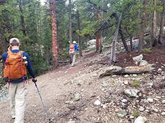
My father, who had been up to Kroenke Lake a few times already, suggested we make the lake our morning destination and spend some time fishing. My son Luke and I joined in and said "let's go." We started off thinking it 4 miles each way and looking at an 8 mile day. About halfway up to the lake my Dad said "well its more like 4.5 miles". Typical trail talk. The ascent up to the lake is very straightforward. We started off from the North Cottonwood trailhead. We had some concern with the parking being full with this being a Sunday hike. We arrived about 5:45am and it was about 3/4 full. We had the trail mostly to ourselves the first 2 miles to the junction. At the first major trail junction Kroenke Lake and Brown's Pass are the left turn while Bear Lake and Mount Harvard are the right turn. After the junction the trail is another 2+ good trail miles up to the Lake. Along the way we looked for the "bushwhack" turn off for Birthday Peak. I found the GPX track of a guy who did Birthday from the Kroenke Lake trail by bushwhacking up a creek bed. We found the faint semblance of a trail in that area and noted it for a future day.
 |
Main trail junction sign
|
 |
Nice bridge for a creek crossing
|
It took a hair over 2 hours for us to reach the lake. It was 8am at our arrival. Weather was looking great with just a few spotty clouds in the sky. My father and son were set to try some fishing in the lake while I decided to hike up to the pass. We agreed I'd be back by 9:30am and target a 10am departure from the lake. My father warned me of all the willows on the hiking above the lake. We ran into a handful of groups camping on the south side of the lake and it looked a fun place to do so. The one thing we would note about the camping we saw was this: there were a number of established campsites and at least two groups that were camping right up next to the lake. It is a part of Leave No Trace ethics in the backcountry to camp at least 200 feet from lakes. It may look like a beautiful and convenient spot but it is hurting the long-term health of the area. So be cool about this and find a different spot!
 |
Can you spot the 4-legged friend in the photo?
|
I left my guys and started up the trail. Just after the lake the trail really starts climbing. The hike up to the lake itself had no real steep portions and was a nice gradual gain the whole way. After the lake is the steepest hiking the whole way. It quickly gains 300 feet in just 3/10 of a mile. There's a big switchback and all of the trail is very easy to follow.
 |
Looking up towards Mt. Yale
|
From about 11900 and onward the trail passes through a large share of willows. For the most part the trail is easy to follow. The big challenge is that when hiking this in the morning you're bound to get wet. And oh did I ever. From a good rainfall the night before and a bit of morning dew these bushes were saturated. I tried to use my trekking poles to knock some of that moisture off but it hardly helped. Every bush I walked through left its deposit of water on my pant leggings. I finally gave up in thinking I had a chance at staying dry. As I embraced my fate my eyes were then opened up to the amazing alpine beauty that was arrayed before me.
 |
Just arriving at the Lake.
|
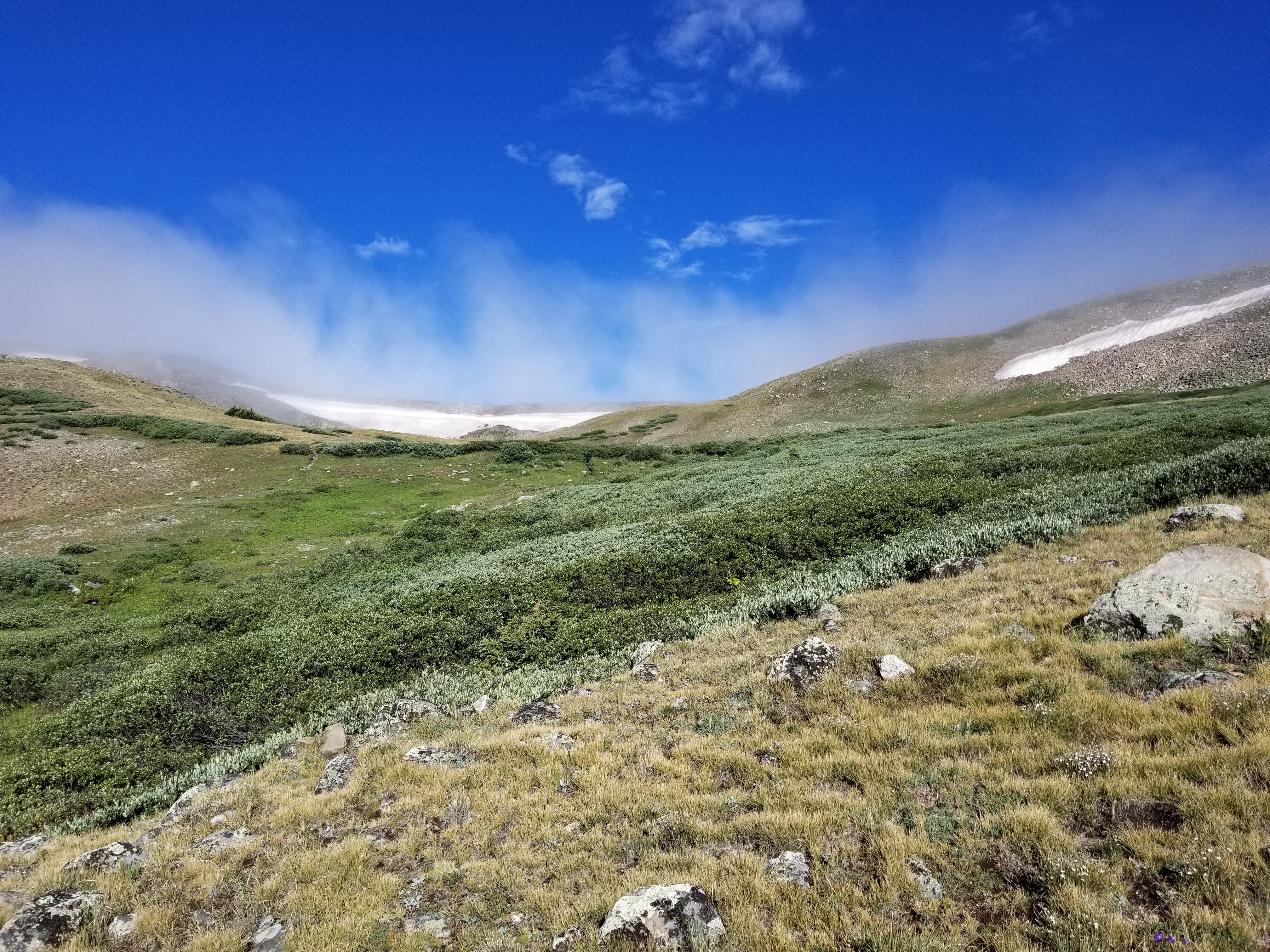
With 360 degrees of views to peaks and mountain ridges and beautiful alpine tundra this area is just downright beautiful. I mean for the most part any alpine area is a sight to behold, but this was full of beautiful life, even the willows, and it all added up to something wonderful. The trail was quite an easy follow all the way up to the pass just above 12,500.
Now it's worth pointing out my turnaround today is not at Brown's Pass proper. I gained a ridge where the trail would continue onward and down to the true Brown's Pass around 12,000 ft. The pass I gained really doesn't have a name but it is along the route to the real Brown's. If it weren't a downward hike with switchbacks, not to mention my slight time constraint, I might have continued onward. My map below shows in orange color the remaining trail to Brown's Pass which I didn't cover today.
 |
Beautiful alpine scenery
|
 |
Still some snow up high over 12,000 ft.
|
 |
On approach to the pass, the white out is beginning
|
When I gained the Pass the area was in a light whiteout. Visibility under 50 yards and things were in the midst of the cloud deck. My views were limited. When I began my descent it was probably 10 minutes later that the clouds lifted and I had wide open views again. I had a slight hope the willows had lost some of their moisture by this time, but those hopes would be dashed. My pant leggings remained wet as could be as I made my descent. Thankfully, I was wearing some REI-brand zip-off pants and they do dry rather well.
 |
At the pass, visibility limited
|
 |
On the descent, things beginning to clear
|
I regained Kroenke Lake at 9:15am and spent a few minutes figuring out where my father and son were fishing. I found them just off the trail on the south side of the lake. My father had some good luck in catching a few rainbow trout. My son had zero luck with it. I pulled out a backpacking chair and sat and read a bit while they fished up til 10am. The weather was still holding up nicely for us and I think with an early enough start we probably could have had a summit today. You just never know what the weather is going to give you.
 |
Probably the money shot of the day. Kroenke Lake below. Mt. Columbia above.
|
At 10am we began our descent and bumped into a handful of groups again along the trail. This appears to be a very well loved area with people taking advantage of and enjoying its beauty. We made it out to the car around lunchtime and headed home.
 |
Pretty good look for a hike out.
This is from the south side of the Lake, several campsites in the area |
Track:
I have a track and waypoints from the hike all contained in the embedded Google Map. Check it out and use at your own risk.


 Distance: 11.23 mi. (my Forerunner 235)


No comments:
Post a Comment