Sunday, September 20, 2020

Teton Crest Loop

Table of Contents
Planning the Itinerary
Training
Packing
Friday, Sept. 18
Saturday, Sept. 19
Sunday, Sept. 20
Wrap-up

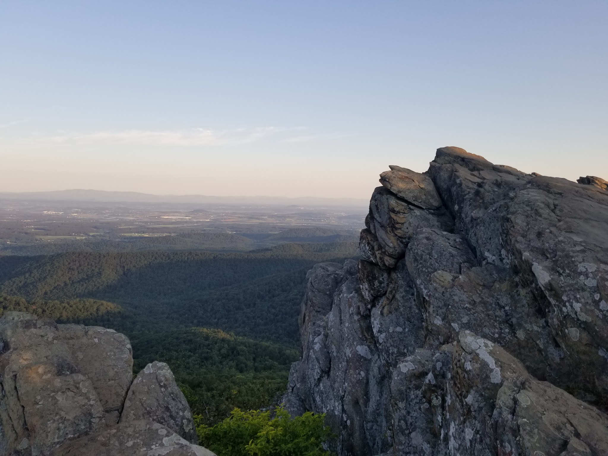
Most Americans are familiar with the Grand Tetons. We've seen the pictures from various vantage points of this jagged row of unmistakable peaks. They are undoubtedly a source of immense beauty. To visit the park ups the ante. Opportunities abound to see unique wildlife, at reasonable distances of course. There are ample trails and wonderful campgrounds to get one up close and person to nature and to this beautiful National Park.

The next step is to get into the backcountry. Its one thing to see the Tetons from their typical side on the east. Its another to hike around to their backside and to take in all new views of these majestic peaks. Not too many tourists into the National Park get further than a mile from the trailhead. To adventure deep into the backcountry, into the territory of grizzly bears and moose is where my brother wanted to head. We're no strangers to this kind of place and we've now long had a love for it.

Thursday, September 17, 2020

Lower Grandeur Peak Loop

Grandeur Peak West Face trail to West Face Alternate trail
Trailhead Elevation: 4,962 ft.
Turnaround Elevation: 6,728 ft.
Grandeur Peak Elevation: 8,270 ft.
Distance: 2.86 mi.
Elevation Gain: 1,779 ft.
Start Time: 1:37pm
End Time: 2:56pm


Trip Report:
With just a couple hours to spare before I would be picking my brother up from SLC airport, I was looking for a fun hike to get the legs loosened up. I just so happened to have been shopping at the REI on the east side of Salt Lake and realized the west face trailhead for Grandeur Peak was just a stone's throw away. This isn't necessarily the main trailhead for Grandeur, nor is it the easiest trail, but it is the shortest route to the summit. I wasn't necessarily gunning for the summit with the limited time I had and I also didn't want to wreck my legs today. My brother and I would have plans for the Teton Crest trail over the next few days and I wanted to stay fresh.

Monday, September 7, 2020

Humpback Rocks (Blue Ridge Parkway)

Humpback Rocks Trail to summit, descent on Appalachian Trail

Trailhead Elevation: 2,371 ft.
Humpback Rocks Elevation: 3,117 ft.
High Elevation: 3,250 ft.
Distance: 4.00 mi.
Elevation Gain: 1,141 ft.
Start Time: 7:04am
End Time: 8:11am


Trip Report:
This hike didn't show up in our original plans for Shenandoah National Park and neither is it in the park. However some local searching for other trails for a morning trail run quickly turned this up as a great option. Its not so much a hidden gem as it appears it is a quite well used trail by locals and others alike. I was glad to have found it and given it a try this morning.

Sunday, September 6, 2020

Blackrock (Shenandoah)

Appalachian Trail/Blackrock Summit Trail to Summit, descent on Blackrock service road

Trailhead Elevation: 2,908 ft.
Blackrock Summit: 3,087 ft.
Distance: 1.26 mi.
Elevation Gain: 217 ft.
Start Time: 11:08am
End Time: 12:08pm


Trip Report:
The Blackrock Summit loop is billed as one of the great short and easy family hikes in Shenandoah National Park. The loop is just over a mile, is fairly easy in elevation gain, and is wonderful with the scenery and ability to scramble on rocks. For us this checked all the boxes.

Saturday, September 5, 2020

Hogback & Hawksbill (Shenandoah)

[Hogback] Appalachian Trail from Little Hogback Overlook to Hogback Overlook with detour to Hogback Mountain summit.

[Hawksbill] Hawksbill Gap up Lower Hawksbill Trail to Hawksbill Summit, descent on Salamander Trail to Appalachian Trail to Spring Cabin Parking area.

Hogback
Trailhead Elevation: 3,031 ft.
High Elevation: 3,464 ft.
Distance: 1.81 mi.
Elevation Gain: 586 ft.
Start Time: 1:27pm
End Time: 2:28am


Hawksbill
Trailhead Elevation: 3,367 ft.
Hawksbill Elevation: 4,050 ft.
Distance: 2.56 mi.
Elevation Gain: 670 ft.
Start Time: 3:42pm
End Time: 4:37pm


Trip Report:
To hike Hogback Mountain we decided to try a shuttle hike. It is entirely along the Appalachian Trail which runs almost entirely along the Skyline Drive. We figured this would be a family-friendly hike and the only way to pull it off, short of doing an out-and-back, was the shuttle option. So we dropped everyone off at Little Hogback Overlook and then Lisa and I drove the vehicles to the Hogback Overlook at the end of our hike. We left one vehicle there and then came back to the starting point. This worked out great for us.

Popular Posts