[Originally published in the Monroe News on Friday, March 8, 2019]
My wife Sarah and I are in the process of welcoming our fourth child into this world. This time around brings us our very first daughter. To finally have a girl has us abundantly excited. We have been blessed to welcome three healthy and rapidly growing boys thus far, the youngest of whom is already 10 years old. That gap between our children, as well as bringing a little girl into the family, has made this pregnancy full of excitement.

Friday, March 8, 2019
Saturday, December 29, 2018
Pinckney Blind Lake Backpacking Dec '18
 Potawatomi Trail
Pinckney State Recreation Area
Trailhead Elevation: 888 ft.
Dec. 28 Hike In:
Distance: 6.94 mi.
Elevation Gain: 185 ft.
Start Time: 2:15pm
End Time: 4:45pm
Dec. 29 Hike Out:
Distance: 4.18 mi.
Elevation Gain: 208 ft.
Start Time: 8:40am
End Time: 10:18am
Trip Report:
Amazingly, it had been a whole year since I was able to get out the backpack to head to my favorite spots at Blind Lake. Last year I had the great adventure in 8 inches of snow and my first taste of snow camping. This year there would be no snow, at least not expected. When I set out on a Friday afternoon the temps were nearing 50 degrees and it was nearly perfect hiking weather. There was little-to-no precipitation in the forecast and it seemed the right time to hike. I even had bits of sun on the hike in. I brought along all of my usual winter gear and plenty of things to keep me warm overnight. For the hike in I wore just a tech short-sleeve and tech long-sleeve shirt with wind pants and that was more than enough. As I hiked in the temps did continuously drop from that nice 50 at the start. I was probably nearing low 30's when I finally hit camp.
Tuesday, October 9, 2018
Lake Charlevoix Kayaking Loop
 Kayaking from Young State Park on a southern loop to Boyne City and back.
Distance: 7.02 mi. (my Forerunner 230)
Start Time: 3:28pm
End Time: 6:28pm
Trip Report:
I was up in the Boyne City area during my annual Pastor's Conference and had brought my inflatable kayak along this year to get in some paddling. The weather, in terms of temperature, was going to cooperate wonderfully. Temps were in the 60's today and quite comfortable for outdoor activity. I had originally looked at something very simple like Deer Lake which is right next to Boyne Mountain Resort. It would be roughly a 3.5 mile loop around the lake and pretty straightforward. As it came to it I felt like I wanted more. I figured Lake Charlevoix would offer that. And its a big lake, Michigan's 3rd largest, not counting the Great Lakes. The question would be where to find a public access point to put in my boat. I've come to realize that Michigan's wonderful State Park system is very friendly to personal watercraft and provides great access to water systems. So I charted a plan to head into Young State Park, down to the public beach, and I could put in there.
Saturday, August 18, 2018
Middlesex Fells - Boston
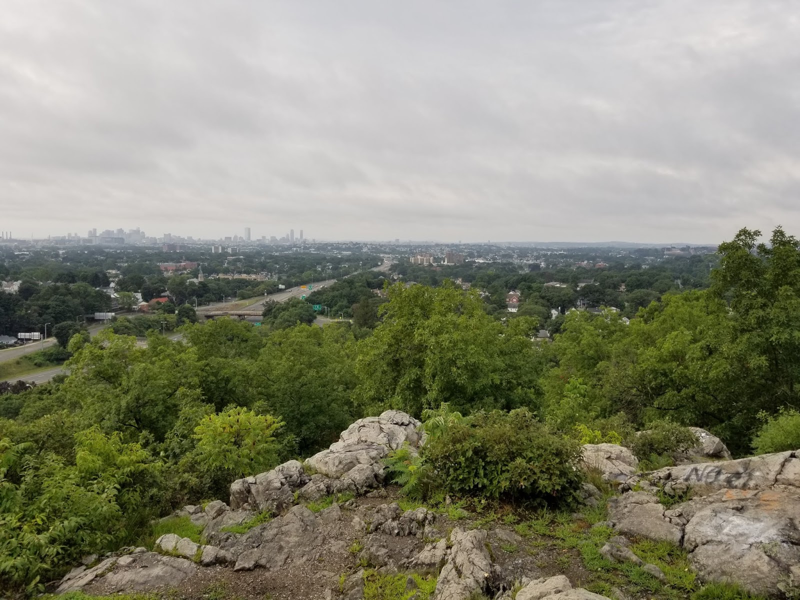
Distance: 3.63 mi.
Elevation Gain: 341 ft.
Start Time: 7:07am
End Time: 8:01am
Trip Report:
The Middlesex Fells Reservation north of Boston is a treasure trove of trails that all Boston-ites should consider themselves lucky to have. As a guest, I also found it wonderfully easy to access and enjoy. I did a minimal amount of research on the trails, stumbling upon the Skyline Trail first of all to get an understanding of what I might want to do. There are also a number parking lots providing immediate access to the trails. I opted to park on the very southeast side to gain quick access to the Skyline Trail.
Thursday, August 16, 2018
Katahdin
 Katahdin
Hunt Trail and the northern terminus of the Appalachian Trail
Trailhead Elevation: 1,089 ft.
Summit Elevation: 5,269 ft.
Distance: 9.78 mi.
Elevation Gain: 4,186 ft.
Start Time: 6:46am
Summit Time: 9:24am (13 mins)
End Time: 12:01pm
Trip Report:
When my wife and I set out to plan a trip to the Northeast to celebrate our anniversary and we settled upon New Hampshire and Maine as our destinations, I knew that Katahdin would have to be a target high on the list of attractions. I haven't fully put a finger on it yet, but for me there has been something majestic about this mountain and how it feels in my mind compared to many others I've hiked. Certainly it is famous and that has something to do with it. Katahdin is the highest point in the State of Maine. Katahdin is also the northern terminus of the epic Appalachian Trail. That latter point is perhaps the most moving for me. All of that aside, it is also just a wonderful hike and mountain climb and one to be enjoyed with great care. As I reflect in hindsight on this hike I have to admit it was much more than I was expecting, and that's a good thing.
Subscribe to:
Posts (Atom)
Popular Posts
-
 As many of my close friends know, J.R.R. Tolkien is one of my favorite authors. I fell in love with his books back in the 90's as I pre...
-
 Route Name: Yakutania Point Trail Start Elevation: 18 ft. High Point: 115 ft. Distance: 2.0 mi. Elevation Gain: ~200 ft. Start Time: 1...
-
 Jump to Lake Michigan Overlook Climb Sleeping Bear Point Trail Sleeping Bear Point is at the northern end of the National Lakeshore. It is ...
-
Route Name: Oak Flat Loop Trail Location: Black Canyon of the Gunnison National Park Trailhead Elevation: 595 ft. Trail High Point: 753 f...
-
 The Skyline Trail loop at Rainier is the premier dayhike for the average tourist visitor to Paradise. I would describe it as your typical N...
-
 Mount LeConte Alum Cave Trail Trailhead Elevation: 3,872 ft. Distance: 11.32 mi. Elevation Gain: 2,935 ft. Start Time: 7:25am End Time: 1:36...
-
 2024 began with the hope and dream of running the Leadville 100 Ultra Race. It had become clear to me that I've been building and prepa...
-
 Mt. Washington to Lakes of the Clouds Crawford Path and Appalachian Trail Summit Elevation: 6,228 ft. Lakes Elevation: 5,051 ft. Dista...
-
 Mt. Antero + Mt. White Brown's Creek Trail to Colorado Trail to Little Brown's Creek Trail Trailhead Elevation: 8,914 ft. Mt. A...
-
 Clingmans Dome from Newfound Gap Appalachian Trail Newfound Gap Elevation: 5,049 ft. Distance: 8.96 mi. Elevation Gain: 2,796 ft. Start Tim...
